Illinois breaks record for number of tornadoes in one year
An unusually active severe weather season in Illinois & Iowa is reshaping what normal looks like
QUAD CITIES, Iowa/Ill. (KWQC) - Illinois is on pace for a historic tornado season.
With 149 confirmed tornadoes as of June 20, the Land of Lincoln is leading the nation in tornado activity — and we’re not even halfway through the year.
Iowa has had an abnormal amount of tornadoes this year, as well. The Hawkeye State has recorded 71 confirmed tornadoes as of June 22, making it the second-highest count across the nation.
Mississippi rounds out the top three with 70 confirmed tornadoes, although that number may increase as storm surveys are ongoing.
What makes this remarkable is how far these numbers exceed the historical average.
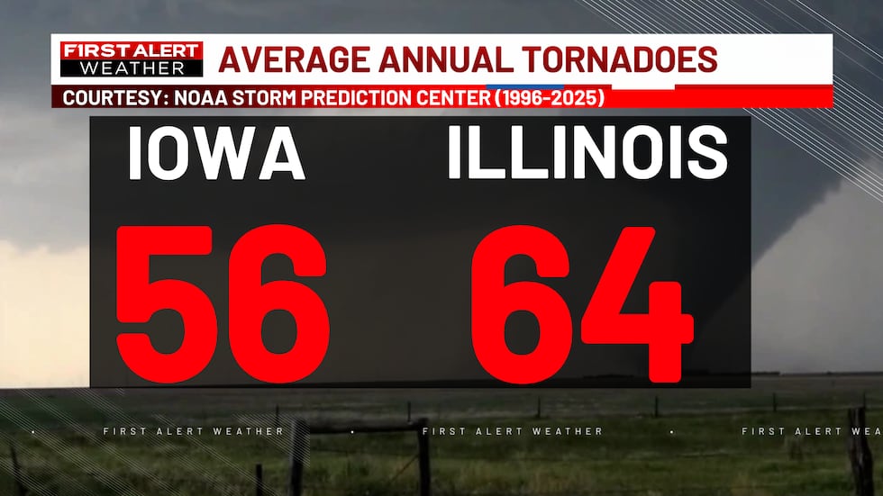
According to the Storm Prediction Center, Illinois typically sees about 64 tornadoes per year over a 30-year period (1996-2025). Iowa averages 56. Both states have already shattered those benchmarks in just six months.
A new record for Illinois
Illinois’ 149 tornadoes represent a new state record — and the numbers keep climbing. More tornadoes touched down on Father’s Day, June 21, and those are still being surveyed and confirmed by meteorologists at National Weather Service forecast offices across the state.
Preliminary counts suggest closer to 200 tornadoes may have occurred, though that figure can include multiple reports of the same tornado.
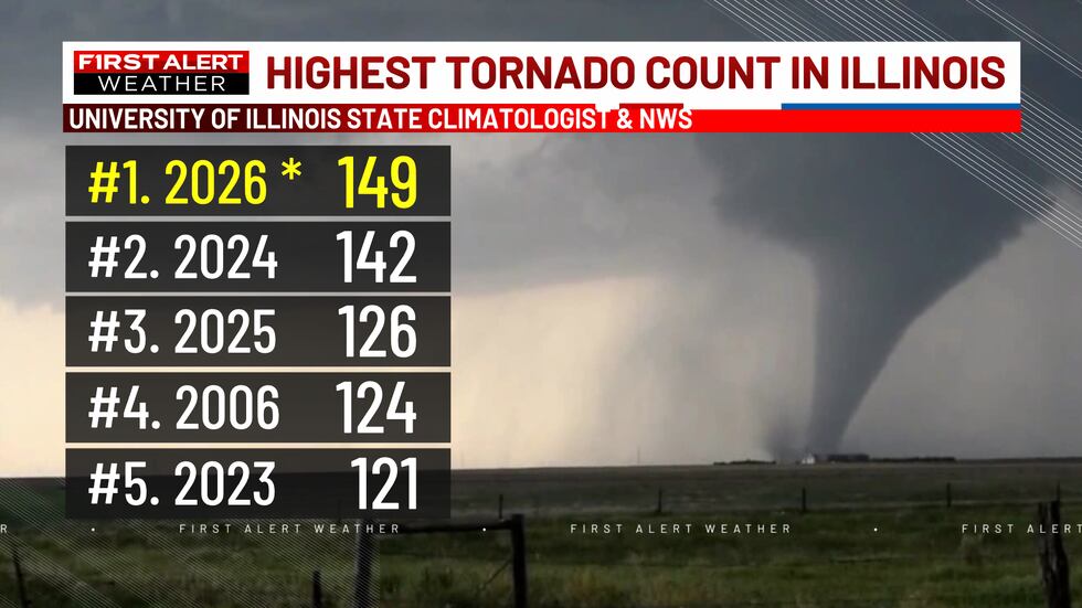
Looking at Illinois’ top tornado years tells the story of a shifting climate:
- 2026: 149 tornadoes (as of June 20)
- 2024: 142 tornadoes
- 2025: 126 tornadoes
- 2006: 135 tornadoes
- 2023: 121 tornadoes
Four of the top five years have occurred since 2023 — a pattern that raises important questions about what’s driving this increase.
Why are we seeing more tornadoes?
The short answer: it’s complicated. Part of the increase reflects improved detection technology rather than a simple increase in tornado frequency. Another part is the unfortunate placement of fronts and air masses, which can be tied back to the weather patterns themselves.
Better satellites: High-resolution satellite imagery makes it easier to spot tornado damage after storms pass. When a tornado tears through a field, the “scar” it leaves behind is sometimes visible from space. This allows meteorologists to confirm tornadoes that might have gone undetected in previous decades.
Radar advancements: The addition of dual-polarization radar has revolutionized tornado detection. This technology transmits both vertical and horizontal pulses, giving meteorologists a clearer picture of what’s happening inside a storm. When debris is lofted into the air by a tornado, dual-pol radar can detect it — even if storm chasers or trained spotters don’t see the tornado with their own eyes.
A broader shift in severe weather
Beyond improved detection, meteorologists have documented a real change in tornado patterns. Studies over the last decade show an uptick in tornado activity and a geographic shift — what scientists call an “expansion” of Tornado Alley. The region where tornadoes are most likely to occur appears to be moving and intensifying.
The takeaway
Tornadoes can happen any time of day, any day of the year. As severe weather patterns continue to evolve, staying weather-aware is more important than ever. Stay with KWQC First Alert Weather for the latest updates and warnings — we’re here to keep you safe.
Copyright 2026 KWQC. All rights reserved.